Preserve the submitted plan
Record the plan exactly as received, including coordinates, bearings, distances, scale, orientation, stated area, annotations and survey references.
 DiKnow TechnologiesUK / Ghana
Document-first site plan analysis
SPV preserves and analyses the spatial evidence already contained in a paper cadastral or site plan before later measurements or interpretations are introduced.
The SPV method
A new field visit can add valuable evidence, but it can also introduce a new date, new measurements and a new interpretation. SPV keeps the original plan evidence distinct and auditable.
Record the plan exactly as received, including coordinates, bearings, distances, scale, orientation, stated area, annotations and survey references.
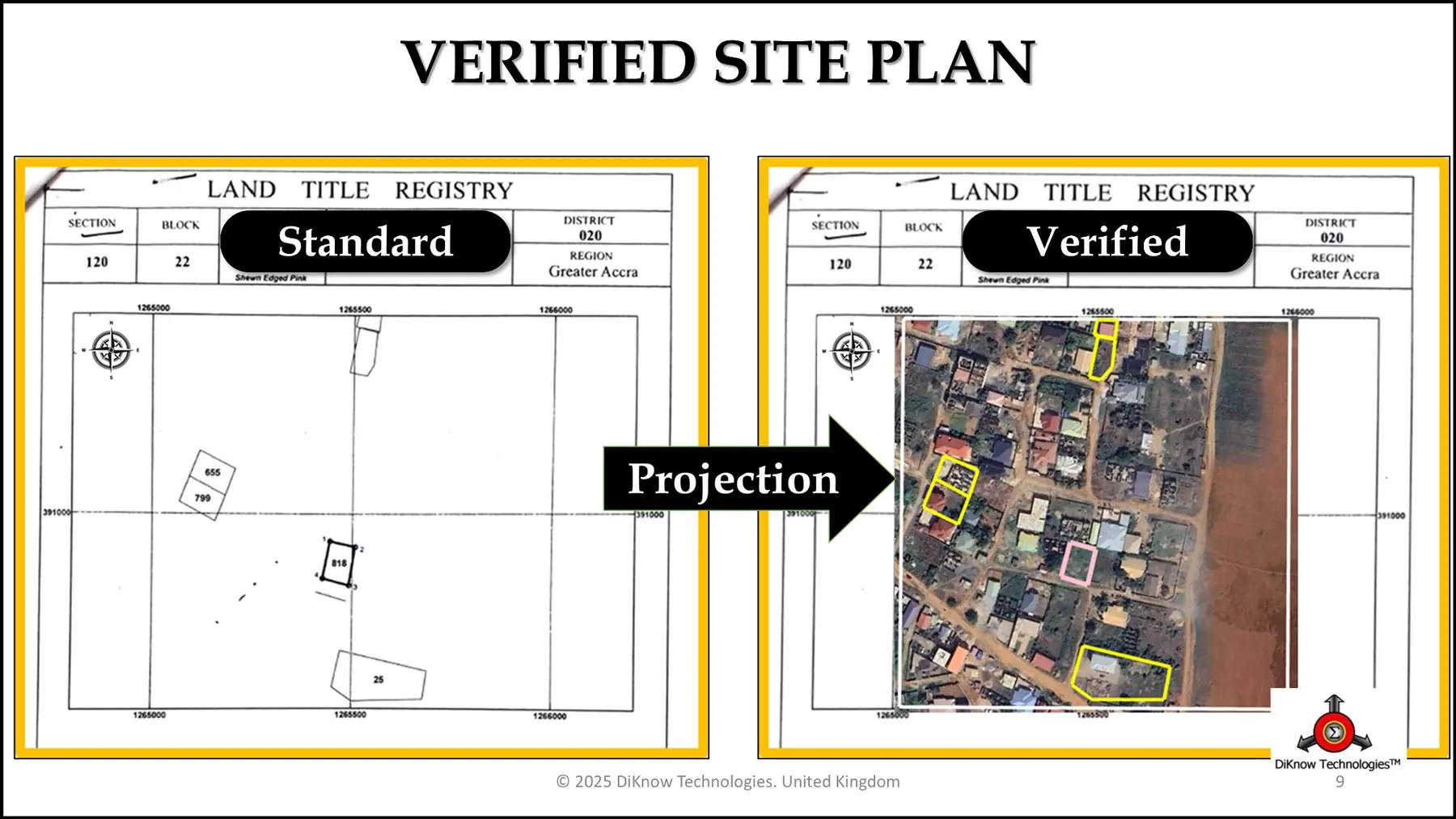
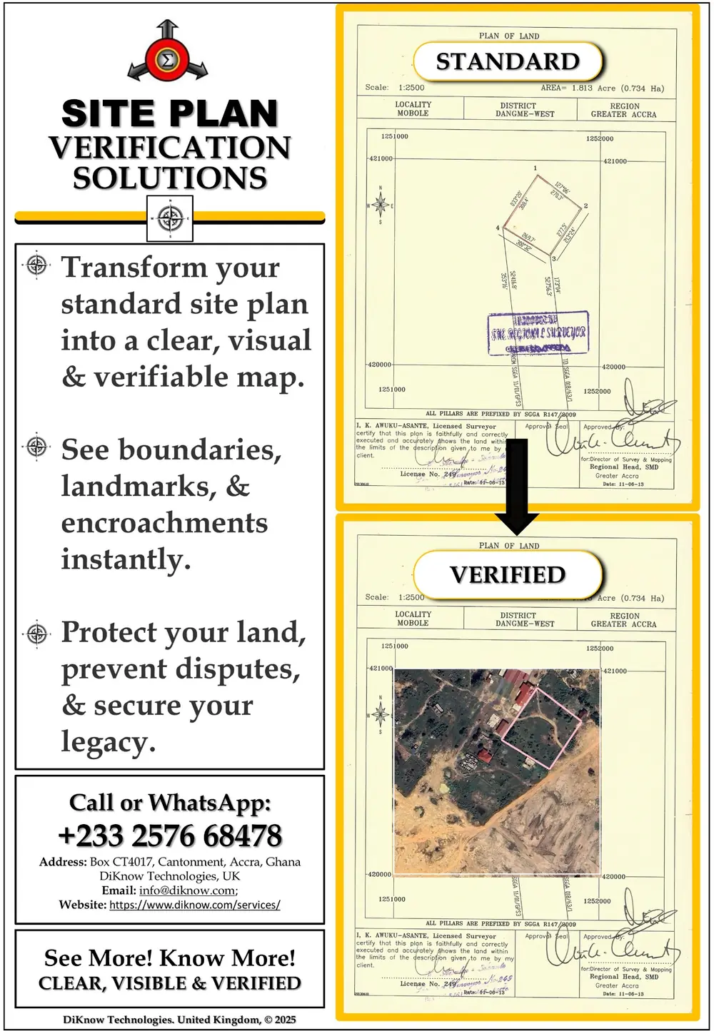
Extract the available plan information and rebuild the parcel as a digital polygon using the appropriate country-specific grid or coordinate reference system.
Place the reconstructed boundary on suitable satellite imagery or basemaps to reveal its claimed location and surrounding context.
Examine Location, Overlap, Size and Environment, including apparent displacement, boundary conflict, acreage differences and relevant surrounding features.
Present maps, measurements and findings, then identify whether official searches, beacon recovery, a site inspection, resurvey or additional expert work is justified.
The LOSE framework
Where does the submitted plan place the parcel, and is that location spatially coherent?
Does the parcel intersect another plan, boundary, claim or mapped feature?
Does the reconstructed or calculated area agree with the acreage or area stated on the plan?
What roads, buildings, waterways, wetlands, development or surrounding features may affect the land?
Focused escalation
Essential coordinates, scale, bearings, distances or reference information cannot be reliably interpreted.
The reconstructed boundary, stated area or mapped location indicates a discrepancy that requires investigation.
Physical evidence on the land needs to be recovered, measured or compared with the submitted plan.
A court, land authority, lender, regulator or professional standard requires a field inspection or fresh survey.
Frequently asked questions
No. Where a legible and sufficiently complete site plan is available, SPV can ordinarily begin by preserving and analysing that plan. Later fieldwork may still be recommended when the findings or an institutional requirement justify it.
No. SPV supports more focused and accountable professional investigation. It does not replace necessary field surveying, official searches or the statutory responsibilities of licensed professionals and authorities.
Yes, provided the plan contains sufficient legible spatial information. The quality and completeness of the source plan determine what can be reconstructed and how confidently it can be interpreted.
LOSE is the SPV verification framework: Location, Overlap, Size and Environment.
Send an enquiry for a document-first SPV review, satellite projection, comparison or professional presentation.
Start an SPV requestSPV provides independent spatial analysis and decision-support evidence. It does not by itself authenticate legal title, determine ownership or replace official land searches, licensed field surveys, legal advice, or decisions of the relevant authorities and courts.